Overview
Stadtwerke München aimed to enhance the MVGO app, a leading public transport provider in Munich, by introducing intermodal routing. This initiative sought to empower users to seamlessly plan journeys across various transportation modes, encouraging sustainable and efficient urban mobility practices.
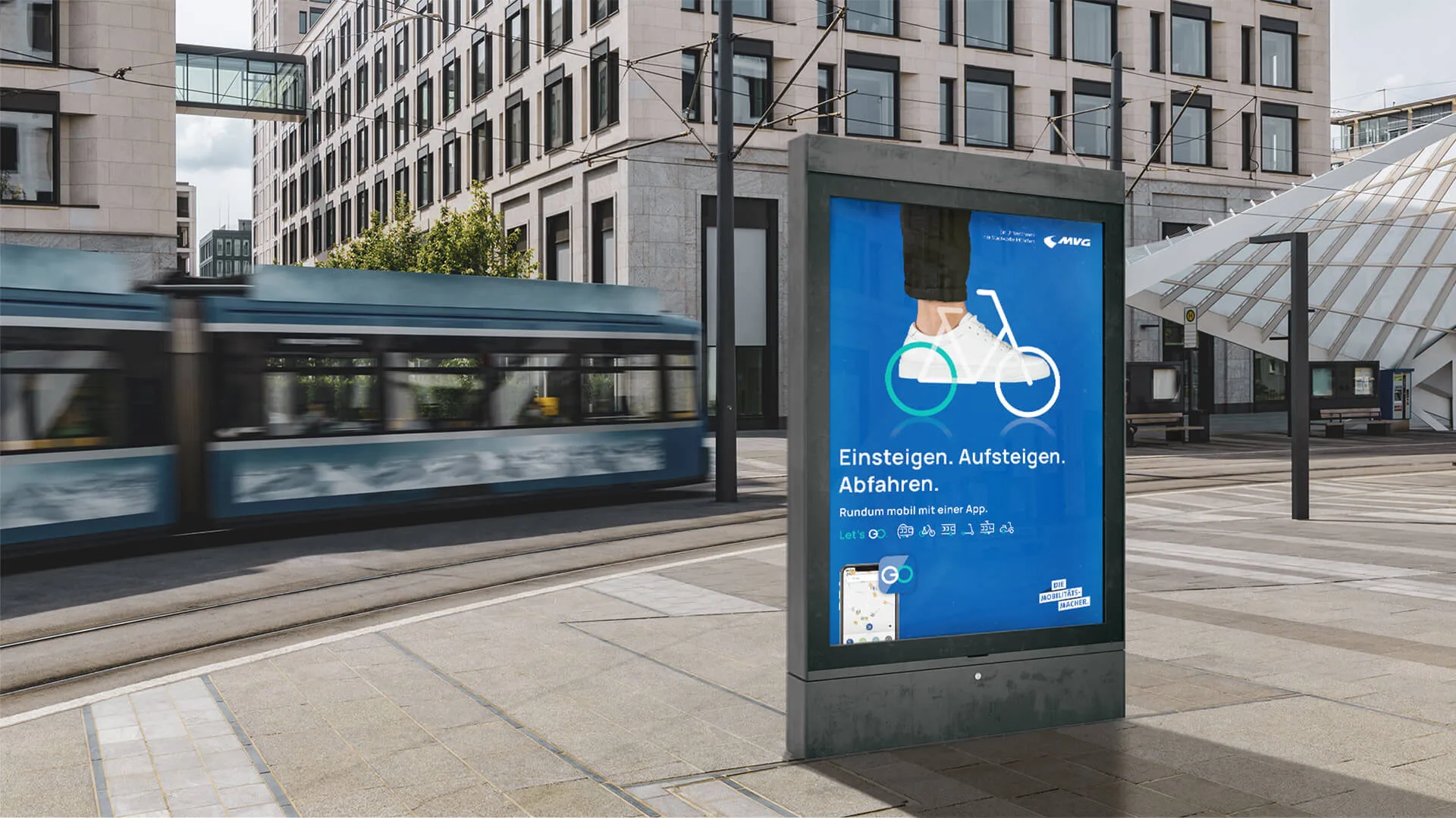
MVGO is the mobility app for Munich. It combines public transport and sharing services: online tickets, connections, live departure times, bikes, e-scooters, taxis and car sharing. At the start of the project it could calculate a route with one kind of transport at a time: public transport, or a scooter, or a bike, or a car.
The brief was routes that use at least two modes, called intermodal routing, placed inside the existing information architecture and offered next to the single-mode routes. The scope was UX/UI design, an app concept and a clickable prototype. We were a team of three: Houtan Ghazi, Maximilian Werner and Ayten Karadeniz.
Challenges
Introducing Intermodal Routing
Integrating intermodal routing into the existing information architecture of the MVGO app presented a significant challenge, requiring careful consideration of user flow and experience.
User Expectations
Managing user expectations regarding shared transportation options, scheduling, and real-time updates became a critical aspect to ensure a positive user experience.
Information Consolidation
Ensuring a cohesive look and feel throughout the app was paramount to address user concerns about inconsistent design elements and fragmented experiences.
Company Vision
Aligning the design with Stadtwerke München's broader vision, extending beyond public transport to provide services contributing to a 24/7 accessible and sustainable city.
Discover
What the client wanted
What the client wanted, what other apps do, and what users said about MVGO.
The first meeting with the client set three things. The company's vision is to keep Munich running around the clock, which reaches beyond public transport to electricity, power supply and other services. The goal of the project is a platform with many ways to get around that makes people rely less on their own car. The challenge is to fit multi-modal routing into the app's information architecture and to manage what users expect from shared transport: where it is, and when.
What other apps do
We compared MVGO with Jelbi, HVV, Transit, Moovit, City Mapper, Google Maps and Bolt on 24 features. Only Jelbi and Moovit offered routes that mix modes. MVGO could not filter by transport type, did not show a price in its route options and did not show all routes on the map.
On the other side, MVGO already sold tickets, rented scooters and bikes, kept a trip history and saved destinations, so the work was about connecting what existed, not adding services.
| Feature | MVGO | Jelbi | HVV | Transit | Moovit | City Mapper | Google Maps |
|---|---|---|---|---|---|---|---|
| Routes that mix modes | No | Yes | No | No | Yes | No | No |
| Filter by transport type | No | Yes | No | Yes | Yes | Yes | Yes |
| Pickup location from the map | No | Yes | No | Yes | Yes | Yes | Yes |
| Price shown | No | Yes | No | No | Yes | Yes | Taxi only |
| All routes on the map | No | Yes | No | No | No | No | Yes |
What users said about MVGO
We interviewed travellers about how they get around and watched two of them use the current app. We also read what users write about seven apps, MVGO, Jelbi, HVV, Transit, City Mapper, Bolt and Moovit, and sorted it into what works and what needs to grow. For MVGO the repeated complaints were payment, buying tickets (redirected to another site, an account first), unreliable disruption data and bike rentals that fail at unlocking, with hidden fees or a bike that is not where the map says.
Four sentences from the sessions ended up shaping the screens.
"Where is the filter?"
The final map has one row of mode filters directly under it: stops, scooters, bikes, cars.
"I need to see the schedule for the public transportation"
Every public transport leg in the journey details has a Schedule button.
"The map and ticket pages look like different apps"
Map, Trips, Tickets and Profile share one tab bar and one set of components.
"I would like to sort by fastest route or least walking"
Journey options have a Sort by menu: best route, least walking, fewest transfers, lowest cost.
Define
Persona: Alex, the multimodal traveller
Who the traveller is, where their morning goes wrong, and the question to answer.
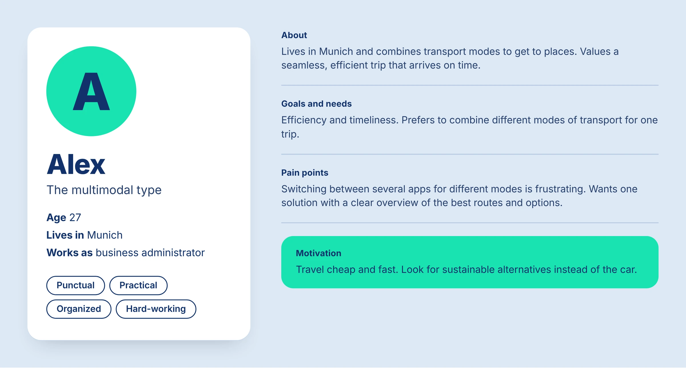
The persona is Alex, 27, who lives in Munich and works as a business administrator. Alex combines transport modes to arrive on time, is punctual, practical and organised, and wants to travel cheap and fast. Alex looks for sustainable options instead of the car, and finds it frustrating to switch between several apps for different modes. What Alex wants is one place with a clear overview of the best routes.
User journey
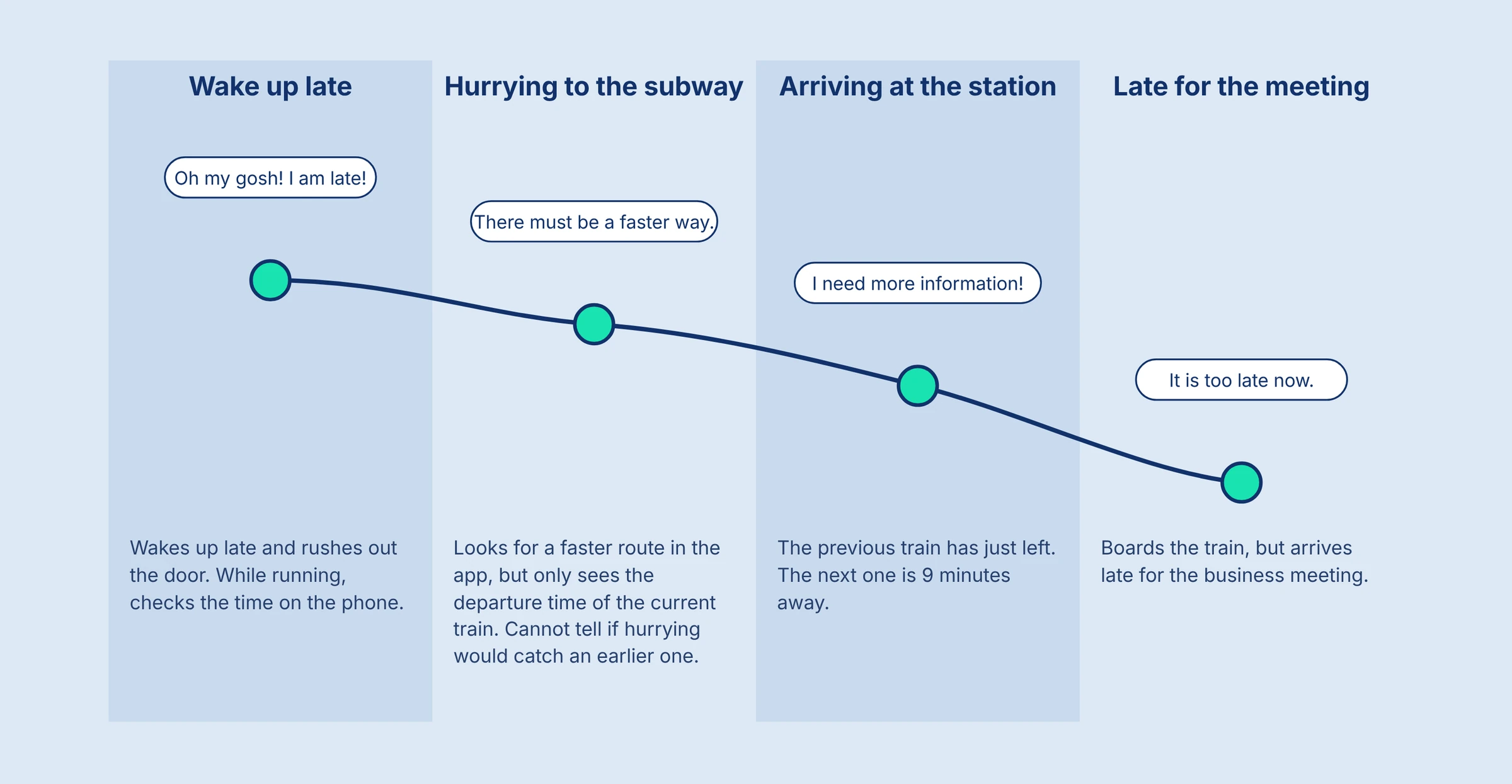
The journey map follows one bad morning in four steps: waking up late, hurrying to the subway, arriving at the station, and being late for a business meeting. In the second step Alex tried to find a faster route in the app but could only see the departure time of one train, so there was no way to know whether an earlier train was reachable by hurrying. At the station the previous train had just left and the next one was nine minutes away.
Problem and question
The problem statement: people want to plan their travel by combining different types of transport and to change their choices easily, to make smart and seamless decisions when commuting and to help the environment by picking eco-friendly options.
The question that followed: how might we design an easy-to-use app that integrates multiple transport options, offers real-time updates, and lets users plan their journeys without relying on other apps?
Design
Ideas
Ideas, a sitemap and a flow, then low and mid fidelity with two rounds of client feedback.
The ideation round, on paper and on a wall, produced five directions: multimodal transportation, filtering of transport types, an overlapping subway map, dropping a pin on the map, and a schedule for departure times. In the highlights round the team picked up filtering (including a filter for sustainable options), offering multimodal transport, a subway navigation filter on the map overview, and adding tickets to the phone wallet so a ticket works without internet.
Sitemap
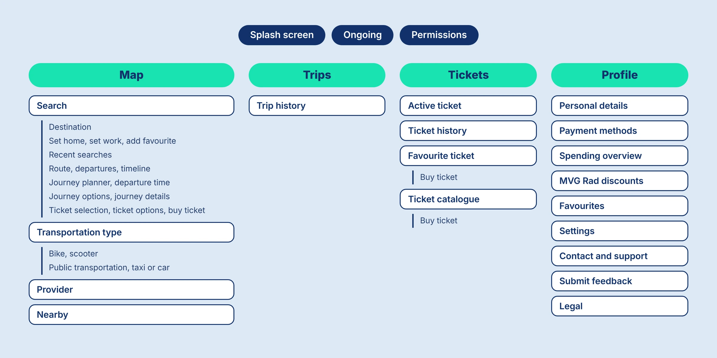
The map stays the home of the app. Under it sit four areas: Trips with the trip history, Tickets with the active ticket, history, favourites and catalogue, and Profile with personal details, payment methods, spending overview, favourites, settings, support, feedback and legal.
User flow
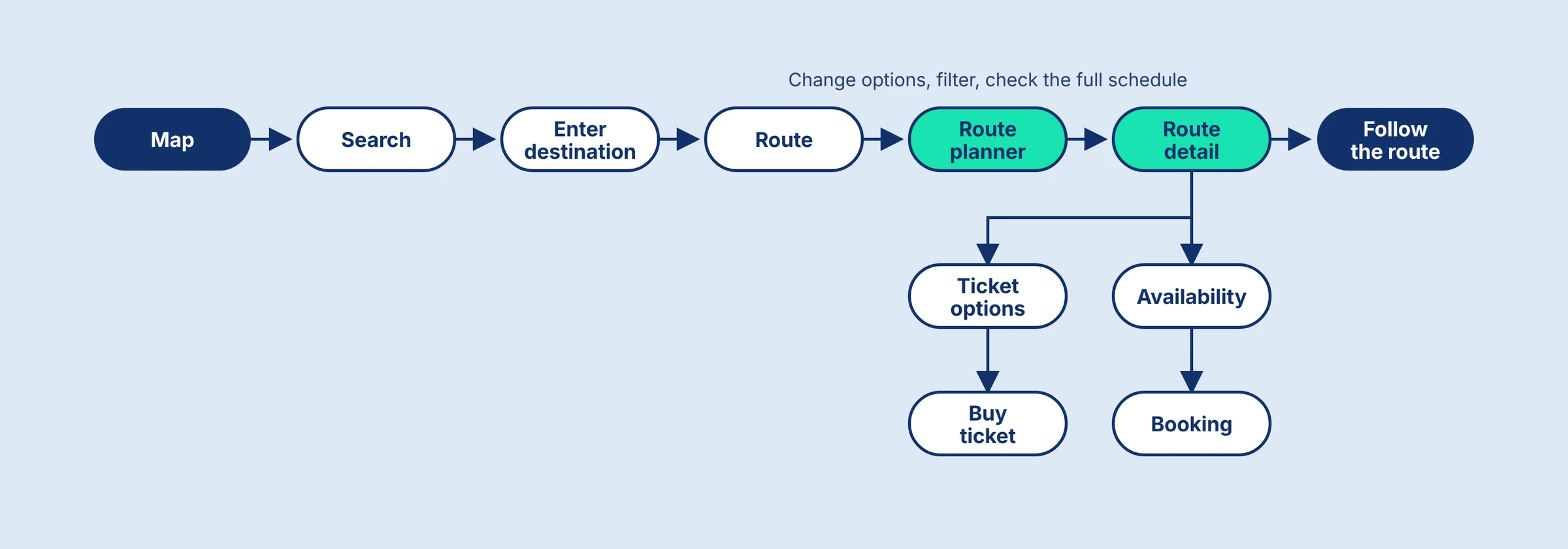
Intermodal routing lives in the journey planner on the map side. The flow is short: search or enter a destination, open the route planner where options can be changed, filtered and checked against the full schedule, open the route detail, and from there check availability, book, choose a ticket and buy it. Following the route is the last step.
Low fidelity
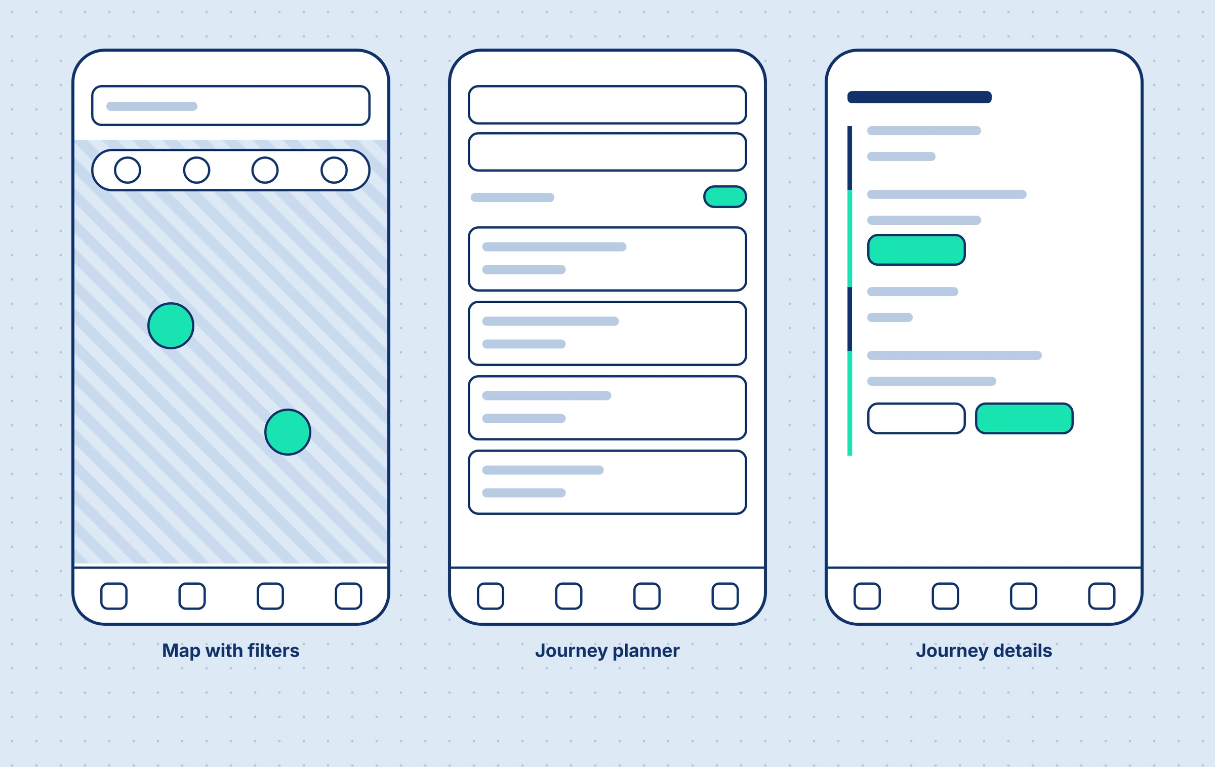
The low fidelity screens were drawn on paper. The first sketches covered the map with its filters, the journey planner with its options, and the journey details.
Mid fidelity
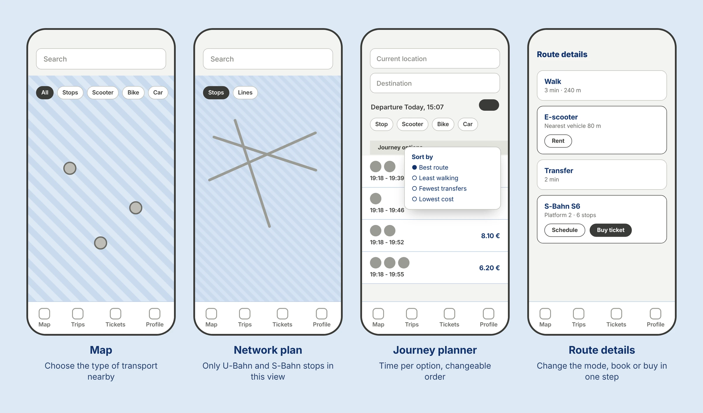
The mid fidelity screens added the ideas as notes on the screens: vehicles nearby with a choice of transport type, route options with an estimated time and a changeable order, and route details that support the user at every step. In the details the user can change the type of transport at any time, sees live trip duration updates after each change, and can book or buy a ticket in the same step. Live departures and hazard notices sit there as well, and the next vehicle nearby can be booked and unlocked directly in the app.
Two rounds of client feedback
After the first round the client asked us not to change too much, to keep the basic design and to put public transport ahead of cars. The second round was positive. The client called the idea revolutionary and a game changer for the industry, and asked for two things: a redesign of the multi-select function, and a polished high fidelity version to pitch to stakeholders.
Deliver
The high fidelity prototype
The high fidelity screens, and what comes after the pitch.
The high fidelity version came out of those two requests. It is a clickable prototype, with a QR code in the presentation that opens it on a phone. The next steps in the plan were the pitch of the prototype to stakeholders and a feedback round with the company's design team.
One map for every way of moving
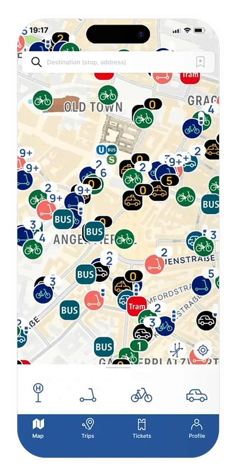
The map is the home of the app. A row of four filters under it switches between stops, scooters, bikes and cars, so one screen answers "what is near me" for every mode. Vehicles that sit close together are grouped into counted bubbles, and the bubbles break apart as you zoom in.
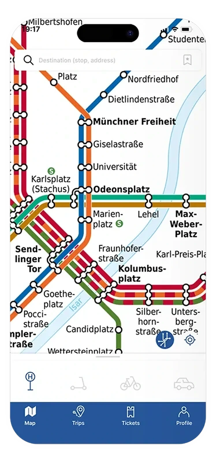
The network plan of Munich is inside the app too, behind the same search field. Someone who thinks in lines and stops gets the plan they know, and someone who thinks in places gets the street map.
Scooters and bikes: provider, price, unlock
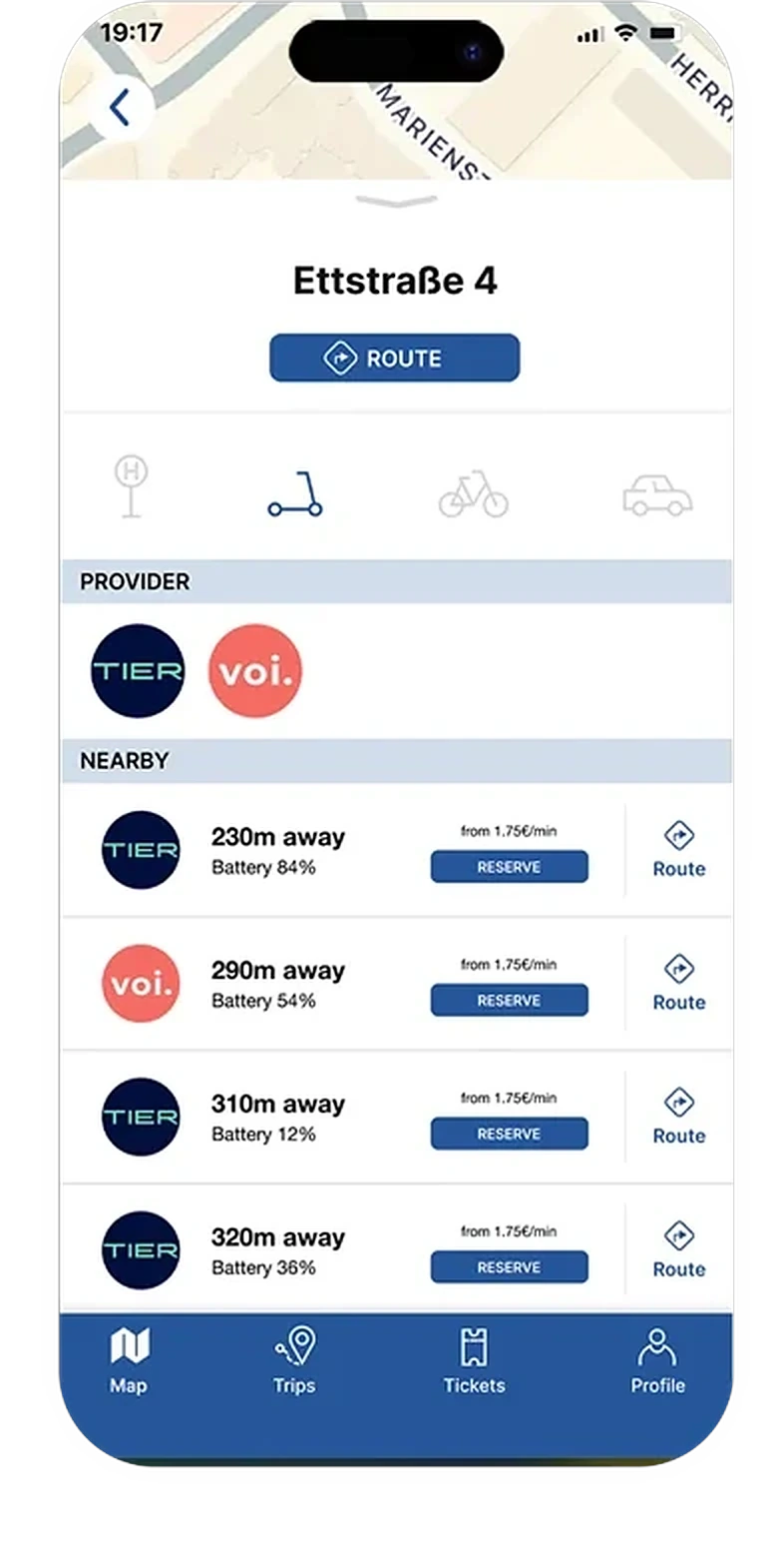
Choosing the scooter filter lists the providers first, then the vehicles nearby, nearest first. Each row shows the distance, the battery level and the price per minute, with two actions: reserve it, or route to it.
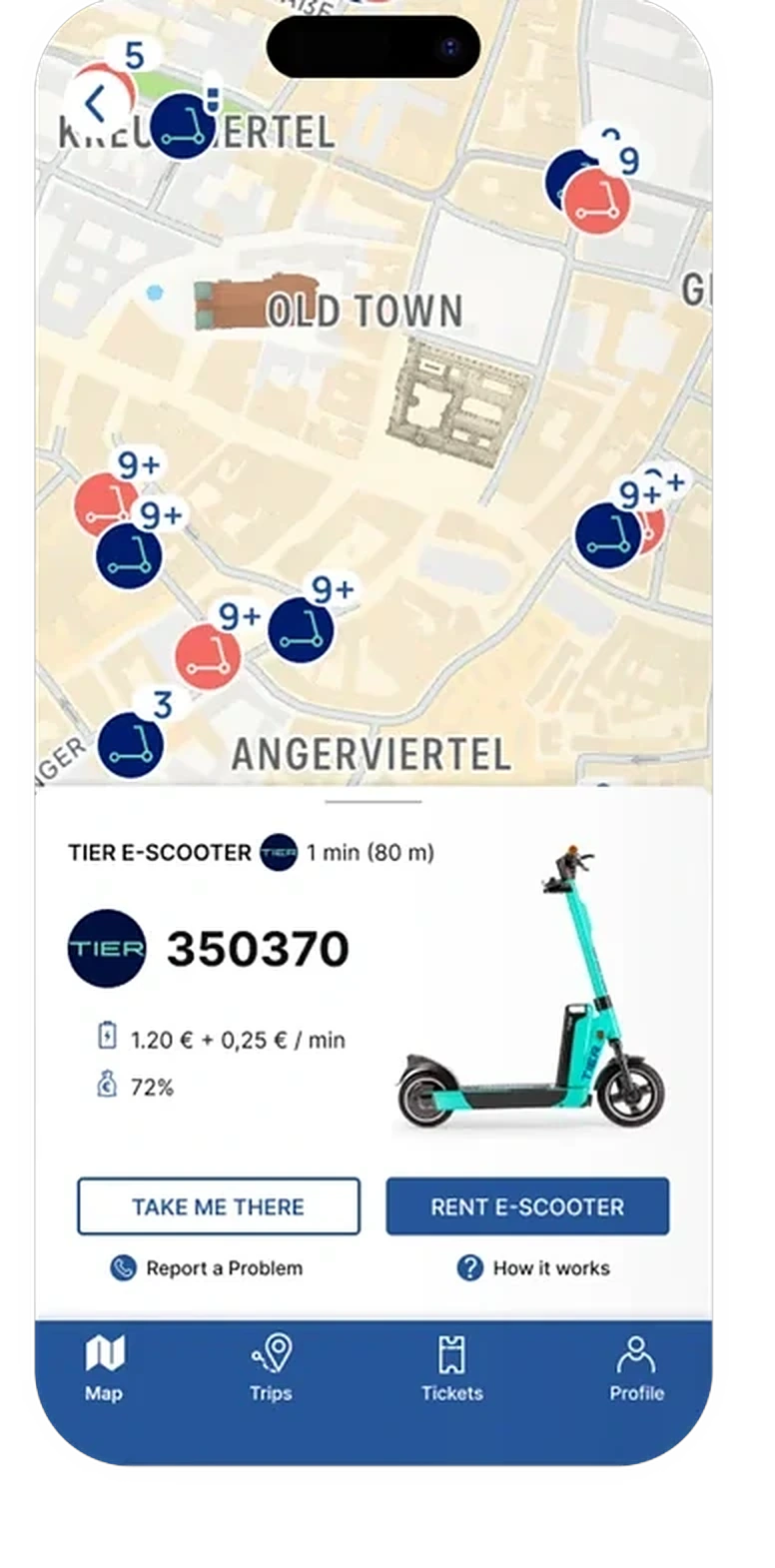
The vehicle card keeps the decision to what matters before unlocking: the vehicle number, the unlock fee and the price per minute, the battery level, and two buttons, take me there and rent. Report a problem and how it works stay one tap away, below.
One planner across modes
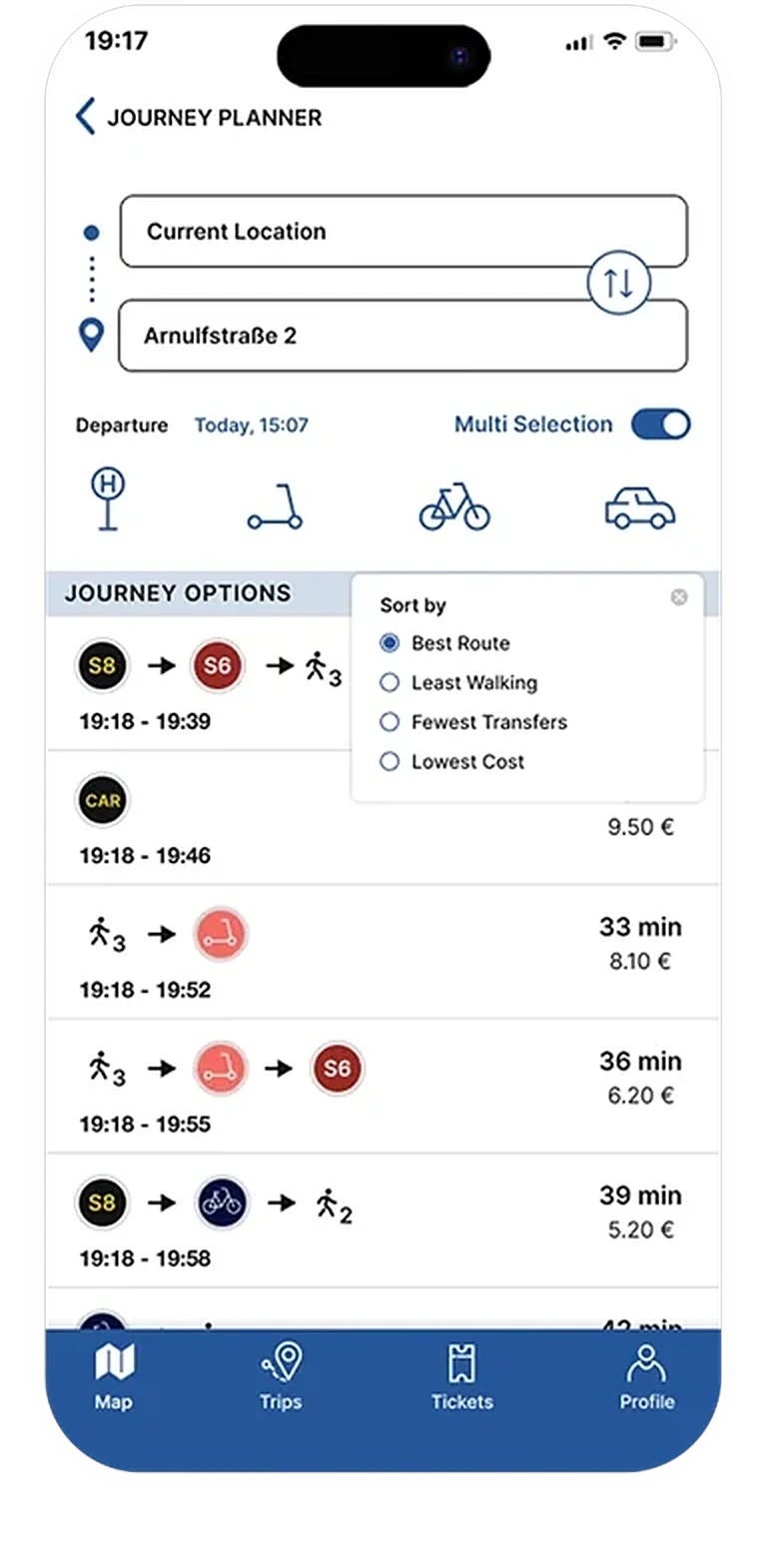
The journey planner takes a start and a destination, a departure time, and a Multi Selection switch. With it on, the options mix modes: train and scooter, walk and bike, or a car alone. Each option is drawn as a chain of mode icons, so the shape of the trip is clear before the details.
Every option shows the times, the duration and the price. A small Sort by menu switches the order between best route, least walking, fewest transfers and lowest cost, because people in a hurry and people on a budget are not looking for the same trip.
Every leg has its next action
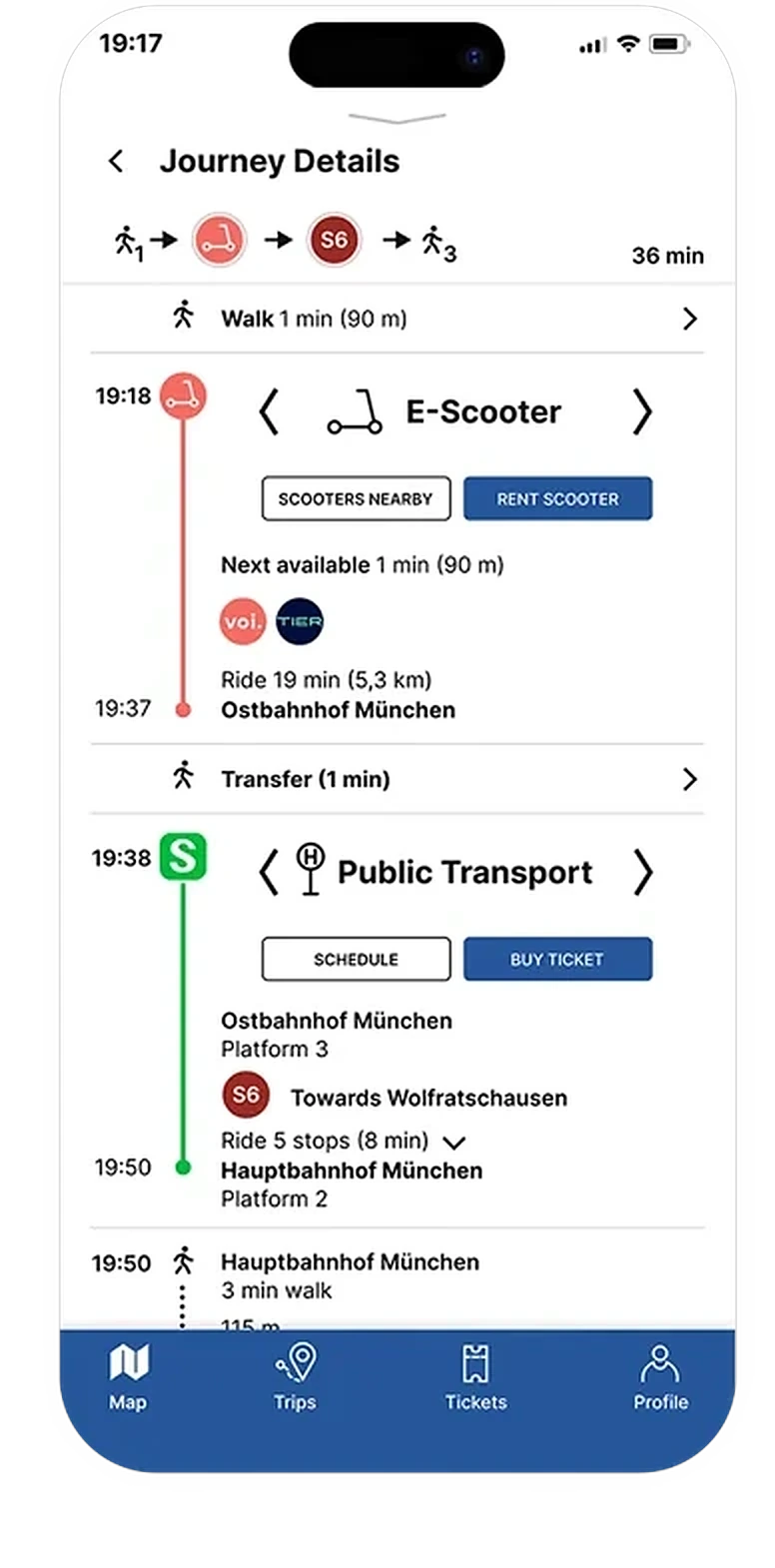
The details screen splits a trip into legs. Walking and transfers show a distance or a time. The scooter and bike legs show the nearest available vehicle and a Rent button. The public transport leg shows the platform, the direction and the stops, with Schedule and Buy ticket.
That is how intermodal routing fits into the existing structure: the planner and the map stay where users expect them, and booking sits inside the journey, so a user plans, rents and buys in one place.